Future Growth in Auburn
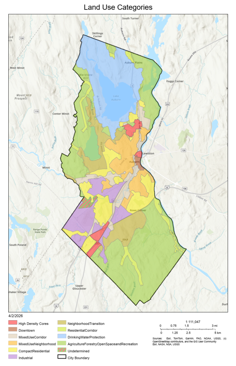
The City of Auburn is inviting community members to review and provide feedback on draft land use maps as part of the comprehensive plan update. These maps illustrate how different areas of the city could grow and change over time and help guide future decisions related to housing, businesses, transportation, and community services.
Through this online open house, you’ll will:
- Review background information
- Explore the draft maps
- Share your thoughts on what future growth should look like in different areas of the city.
Thank you to those who attended in-person open houses or provided feedback online. These activities are now closed.
All comments and input will be reviewed by the Comprehensive Plan Committee and used to refine and improve the land use maps before they are finalized.
Your participation is an important part of shaping Auburn’s future. Thank you for taking the time to share your thoughts.
Growth Area Map
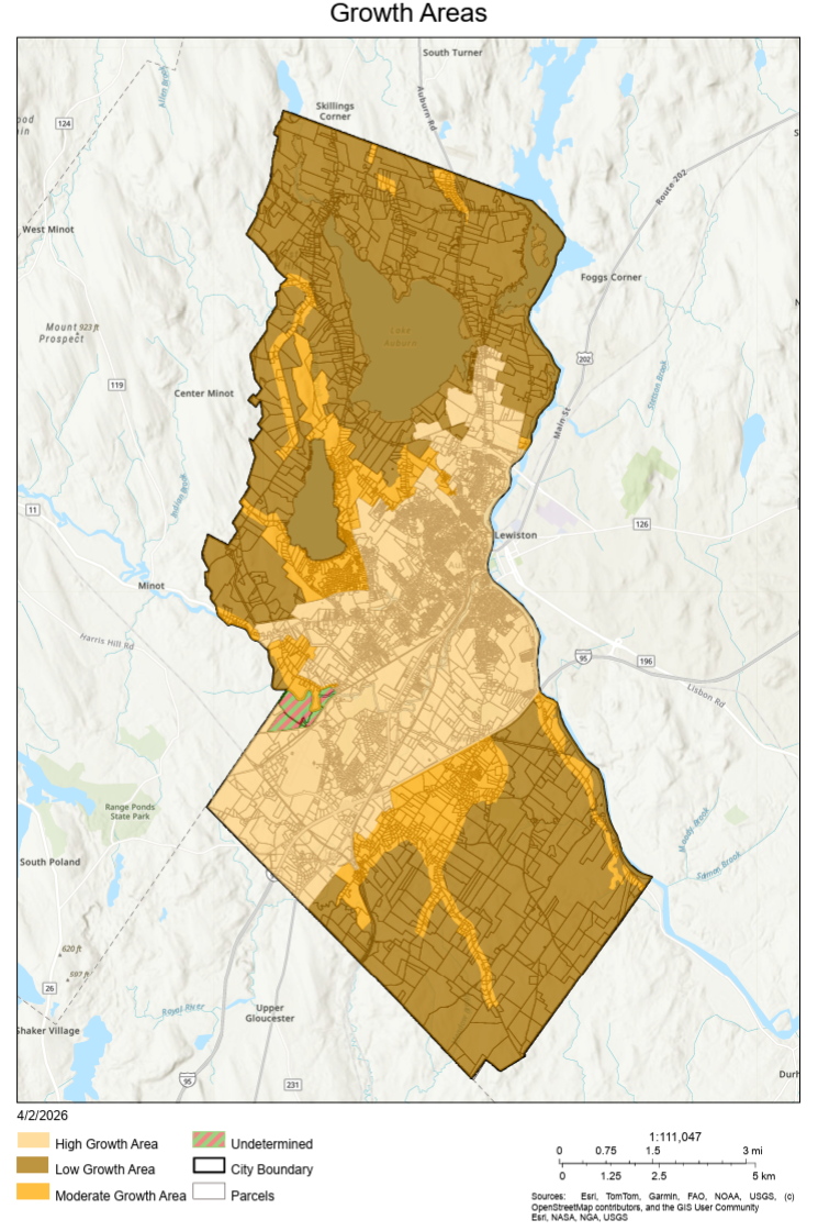
Legend:
Brown areas (around the City's border): low growth area
Tan areas (center of the map): high growth area
Gold areas (edge of high growth): moderate growth area
Land Use Category Feedback
The following set of questions will ask you to review a series of images and select the images that you would like to see more of in a particular land use category.
The images shown represent a spectrum of development types that may be appropriate in different areas of Auburn.
In this activity, select the images that most closely relate to the size, scale, and type of development that you would like to see in the defined area. Choose as few or as many options as you would like.